
Hike amid cottonwoods, migratory birds, and the sandy shores of the Columbia to a historic lighthouse
Oregon’s largest island—the largest island in the Columbia River, (and one of the largest river islands in the continental United States)—Sauvie Island is a fascinating place to take a hike. Located a mere 10 miles downriver from one of the largest cities in Cascadia, only about 1,200 or so folks reside on the 24,000-plus acre island. Much of the island remains in agricultural use and as a wildlife preserve. Within the preserve are several miles of trails. The hike to the Warrior Rock lighthouse—one of two non-coastal lighthouses in the state—is the longest on the island. Bird watching is exceptional on the island, and if you’re into Northwest history, Sauvie will satisfy your yearning for learning.
On October 28, 1792, Lt. William Broughton sailing under Captain George Vancouver, visited the rocky tip of the island where he was met by 23 canoes carrying 150 Chinook Indians dressed in war attire. He quickly made peace and subsequently named the point, Warrior Rock (he also named Mount Hood for his admiral). Lewis and Clark came through in 1805 and 1806. In 1836 French-Canadian Laurent Sauvé began managing several dairy farms for the Hudson’s Bay Company at nearby Fort Vancouver. The island bears his name.
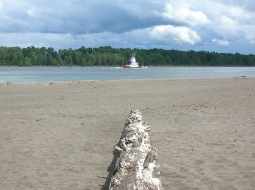
Hike on Oregon’s largest island among stately cottonwoods and sandy beaches to one of its two non-coastal lighthouses. En route watch barges and tugs and all kinds of other watercraft ply the Columbia. It’s a scene right out of the Mississippi—until you cast your eyes upward to Mount St. Helens in the distance. The birding is good too—with over 150,000 migratory ducks and geese taking to the island each fall and winter—so don’t forget your binoculars.
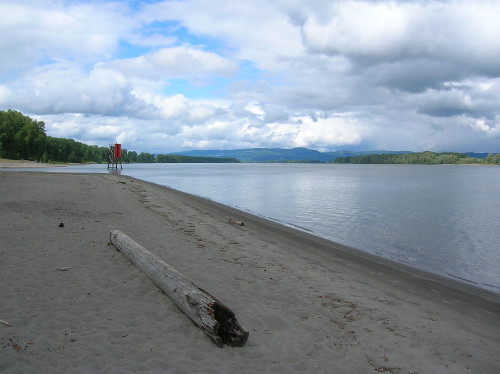
Start by walking out on the fine sandy beach and heading north. If the weather is nice, you’ll have a hard time resisting lounging. After a quarter mile head up on the riverbank picking up an access road for the wildlife management area and proceed right. At .5 mile bear right onto the more lightly-traveled older road. Now follow this delightful way under a canopy of giant cottonwoods to the lighthouse. Several trails diverge left and right offering access to beaches and sloughs. Soothing bird song fills the air occasionally interrupted by the harsher sounds of large vessels plying the river.
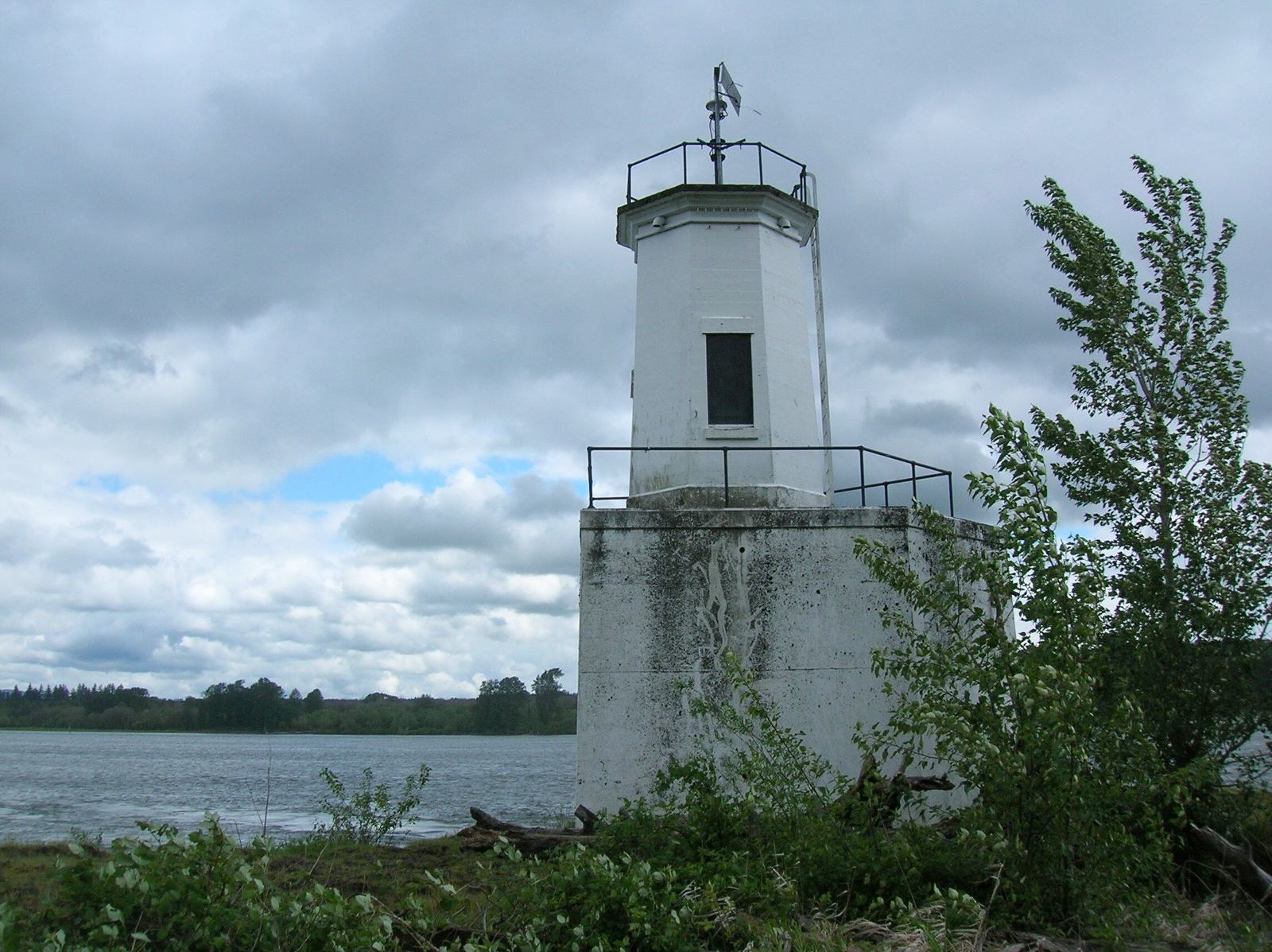
After coming to a small meadow, the way bends right to end at the lighthouse, built in 1930. The currents are pretty strong here being close to the confluence with Washington’s East Fork of the Lewis River. Views are good up and down the river. Directly across the river is the Ridgefield National Wildlife Refuge. Walk a nice beach just to the north of the lighthouse and snoop around the tip of the island for views of the city of St. Helens across Multnomah Channel.
 Award-winning author and hiking expert Craig Romano knows the best places to get out and explore. As a guidebook author of 20 books including many in the immensely popular Day Hiking series from Mountaineers Books, he’s the regional authority on hikes for all four seasons, from the Columbia River Gorge to the North Cascades to the Selkirks.
Be sure to check out his author website, and purchase his hiking guides here.
Photo credits: all images of Sauvie Island and Warrior Rock lighthouse by Craig Romano.
Location: Sauvie Island Wildlife Area, Sauvie Island, Oregon
Roundtrip loop: 6.5 miles (10.5 kilometers)
Elevation Gain: minimal
Difficulty: easy
Trail Notes: Oregon Department of Fish and Wildlife Parking Permit required ($10 day/ $30 annual). They can be obtained from the ODF&W office on Sauvie Island as well as at the Cracker Barrel Store and Reeder Beach Country Store also located on the island. Dogs permitted on leash; kid-friendly.
Contact: Sauvie Island Wildlife Area, Oregon Department of Fish & Wildlife.
Getting to the Trail
From Portland: follow US 30 west for 11 miles and turn right onto the Sauvie Island Bridge. Then follow Sauvie Island Road passing Cracker Barrel Grocery (where parking permits can be purchased) and turn right onto Reeder Road at 2.1 miles. Then follow Reeder Road for 12.7 miles to its end and trailhead.
Did you find this article helpful or informative? Please consider sending a donation our way! Cascadia Magazine is a reader-supported publication, and we depend on your generous financial support to pay writers like this a fair rate for their work.