
A former mining area in the Fraser River Valley is now a pleasant four-season hike
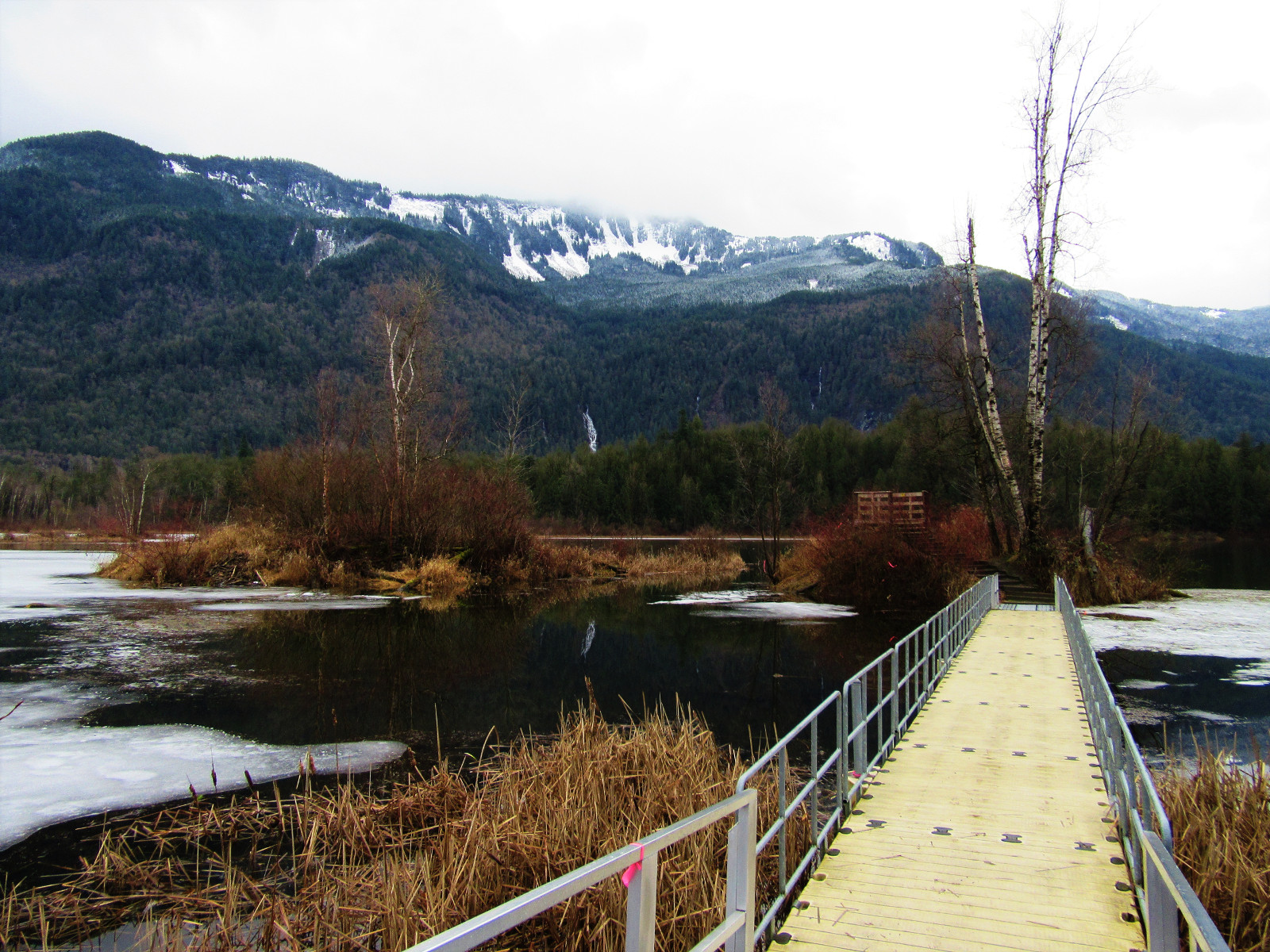
Once logged and later drained for a mining operation, Cheam Lake has since been restored and is again thriving with wildlife. Walk through groves of attractive conifers, across wetlands and along the lakeshore and see, hear, and feel the pulse of the rebirth of an ecosystem. The forest surrounding this large lake wedged between the Fraser River and towering 6,903-foot (2,104 m) Mount Cheam reflects beautifully upon the lake’s placid waters.
From the parking area find an inviting picnic ground along with a kiosk and small interpretive display on the area’s mining history. The lake was mined for its marl limestone; a calcium carbonate mud containing silts and clay and valuable as a fertilizer. Marl is formed underwater; soil deposits (in this case, old landslides from Mount Cheam) are bonded by an algae—chara—to form marl. The lake was drained in 1949 to expedite mining, formerly done by slurry suckers. By 1961, more than 34 tons of marl was being mined annually. In 1988, the marl was depleted, and in 1990 the lake became a regional park, and efforts began (and continue today) to restore this area to its natural state.
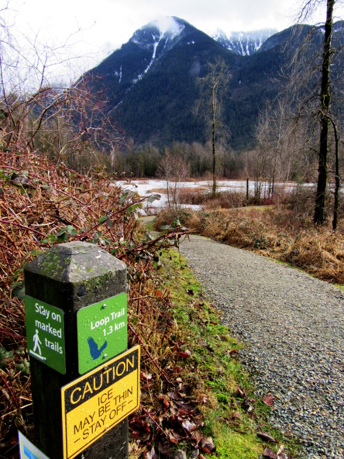
There are three trails that take off from the parking and picnic area. All three are easy and they will be especially enjoyed by young explorers. Each of these trails highlights a different aspect of this 250-acre park. The shortest heads to a floating platform on the lake leading to a small island with an observation deck. You can pretty much see the entire lake from this vantage, making it ideal for birdwatching. During the winter months a handful of tundra and trumpeter swans take refuge at the lake. Views of neighboring Mount Cheam are pretty impressive, too. During the winter months Bridal Veil Falls is quite pronounced forming a silver streak on the deep emerald lower slopes of the peak.
The Loop Trail heads south to skirt the lake’s eastern shoreline and pass by a quiet wetland pool. It then reaches a junction on a forested mound. Here the actual loop begins and it makes no difference which direction you choose to follow. If you go left you’ll immediately come to a long bridge crossing over a beaver dam. Linger on the bridge for a while and you may see one of the industrious rodents. The trail then meanders through groves of cedars and cottonwoods.
The park’s other trail, the Creek Trail, leaves from the Floating Walkway Trail. This trail follows along the lake’s outlet creek. You immediately drop into what feels like a trench. Back in the 1940s the marl mining operation greatly deepened the creek bed through the use of explosives to hasten draining the lake. Today the restored lake provides a healthy flow into the creek.
Follow the trenched creek to a bridged crossing. Then reach a junction. The trail now loops. You can stay right in the trench and return on the paralleling path above the trench. And while these two paths are just meters apart, the ambience is quite different. Along the creek you feel like you’re deep in the woods, while above the creek you can see out to adjacent farms and neighboring peaks.
While each season at the Cheam Wetlands presents its own joys and surprises—evenings any time of the year are always magical. Wildlife is usually most active at this time, and the placid waters of the lake nicely reflect blood red skies and the sun setting through a veil of low clouds on the horizon.
For more details on nearby easy hikes just over the border, pick up a copy of my new book, Urban Trails Bellingham (Mountaineers Books).
 Award-winning author and hiking expert Craig Romano knows the best places to get out and explore. As a guidebook author of 20 books including many in the immensely popular Day Hiking series from Mountaineers Books, he’s the regional authority on hikes for all four seasons, from the Columbia River Gorge to the North Cascades to the Selkirks.
Be sure to check out his author website, and purchase his hiking guides here.
Photo credits: all photos of Cheam Lake Wetlands by Craig Romano.
Location: Cheam Lake Wetlands Regional Park
Popkum, Fraser Valley Regional District, British Columbia
Roundtrip: 2.5 miles (4.0 kilometers)
Elevation gain: minimal
Difficulty: easy
Trail notes: dogs prohibited, kid-friendly
Trail highlights: reclaimed lake, exceptional bird watching, floating walkway
More info: Cheam Lake Wetlands Regional Park
Getting to the trail:
From Vancouver, BC: follow Trans-Canada Highway 1 east to Exit 138 (12 miles /20 kilometers east of Chilliwack). Turn left and then turn left again on to Yale Road E and follow it east for 0.6 mile (1 kilometer). Then turn right onto Popkum Road N and drive 0.4 mile (600 meters). Then turn left onto Elgey Road and drive 0.6 mile (1 kilometer) to park and trailhead.
Did you find this article helpful or informative? Please consider sending a donation our way! Cascadia Magazine is a reader-supported publication, and we depend on your generous financial support to pay writers like this a fair rate for their work.