
A small island in British Columbia’s Fraser River Delta, Deas Island offers several miles of delightful easy hiking trails, good river views, excellent birdwatching, and some fascinating history and historic structures. While the island receives a modest share of visitors, millions of folks have driven right past (rather right under) the island over the years. The Massey Tunnel on BC 99 connecting Delta to Richmond begins its descent under the South Arm of the Fraser River at Deas. Perhaps you too have buzzed right by under the island unaware of the cultural history and recreational opportunities above you.
The island, which is now connected to the mainland thanks to a little engineering work over the years, is named for John Sullivan Deas, a biracial tinsmith originally from Charleston, South Carolina. In 1858 Deas joined a black migration party for San Francisco. But facing an uncertain future and discrimination, he and several other black migrants headed to British Columbia for the Fraser River gold rush. In BC, Deas still faced discrimination, but was able to own land, vote, and hold business licenses.
In 1871 Deas started a fish-canning operation on the island now named for him. Through financial backers he was able to pre-empt and purchase a large plot on the island. Initially his cannery was quite successful, but later growing competition led him to leave for Portland, Oregon in 1878. An old boiler from the cannery as well as dikes that were constructed by Deas are all that remains on the island of his operation. One of the park’s trails, the Tinmaker’s Walk, commemorates him.
While the canneries that once flourished on the island are long gone, you can hike past three heritage buildings, though none of them were originally built on the island. They were moved from Ladner to their current location in the park. The three buildings are all clustered near the park entrance and trailheads for Tinmaker’s Walk, Slough View, and Tidal Pond Trail. Check out the Inverholme Schoolhouse, a one-room school house built in 1909; Burrvilla, a beautiful two-story Queen Anne Revival home that was owned by a wealthy Delta family; and the Delta Agricultural Hall, a grange-like building.
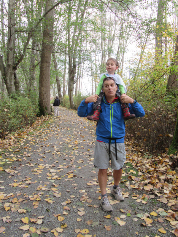
So now that you’ve had your history lesson, it’s time to start hiking the 300-acre park encompassing the island. A grand circuit of the island entails heading out on the Tinmaker’s Walk to the Riverside Walk and then an out and back on Island Tip Trail. Then return to your starting point by following the Sand Dune Trail to the Dyke Loop Trail to the Slough View Trail and finishing up on the Tidal Pond Trail. This configuration has you hiking a good portion of trails in the park for a grand loop of around 2.7 miles (4.5 km).
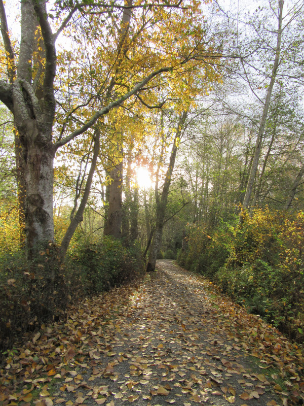
You’ll pass an observation deck on the river granting good views to Lulu Island, the Burnaby skyline, and Mount Seymour and its ski slopes. Much of the island is graced with towering cottonwoods that add nice golden touches in autumn. You’ll cross over the highway tunnel, passing a monument honoring its opening in 1959, which was attended by Queen Elizabeth II. The tunnel is nearing the end of its life and may be replaced with a bridge (which could impact the island). The Queen, however, appears to still be going strong!
The eastern end of the island contains some small dunes and sandy areas, plus good views out to Kirkland Island and the South Arm Marshes. The Slough View Trail includes some excellent viewing points into Deas Slough. During late fall and early spring this is an excellent place to observe migratory birds. Finally, the Tidal Pond loop with its bridges crossing small channels is a good place to spot birds and small mammals.
All photos courtesy of Craig Romano.
Craig Romano is an award-winning author of more than 20 books. For detailed information on nearby hikes just over the US-Canadian border, pick up a copy of his Urban Trails Bellingham (Mountaineers Books).
Location: Deas Island Regional Park, Delta, BC
Distance: 4.7 miles (7.6 kilometers) of trails
Elevation gain: minimal
Difficulty: easy
Trail notes: some trails on the island are also open to horses; Tinmaker’s Walk is accessible to wheelchairs; dogs permitted on leash; Practice Leave No Trace principles; park open from 7am-8pm after March 7
Trail highlights: Island in Fraser River Delta; excellent bird watching opportunities; Island contains three Heritage buildings
Contact: Deas Island Regional Park
Getting to the trail: From Vancouver; Follow BC-99 south to Exit 28 (From Seattle follow I-5 north to BC 99 to Exit 28). Then follow BC 17A (River Road) north for 1.7 miles (2.8 km). Turn left onto Deas Island Road, enter regional park and come to parking and trailhead in 0.6 mile (1 km).
If you find articles like this informative, please consider becoming a supporting reader of Cascadia Magazine. We rely on the generous financial donations of readers like you to pay our writers a fair rate for their work. You can make a contribution at any level you’re comfortable with at our donate page.
And if you’re already a supporting reader, thank you!